
Alta Murgia karst pastoral Trail

A 4 stages trek across the Alta Murgia National Park.
We will be staying in charming farmhouses, walking across oak woods, ancient ‘tratturi’ sheep trails 🐑 and scenic mule tracks where cattle fences known as ‘jazzi’ and ‘poste’, wide cornfields and straw houses called ‘pagliari’ and ‘pescare’ will fill our eyes with marvel.
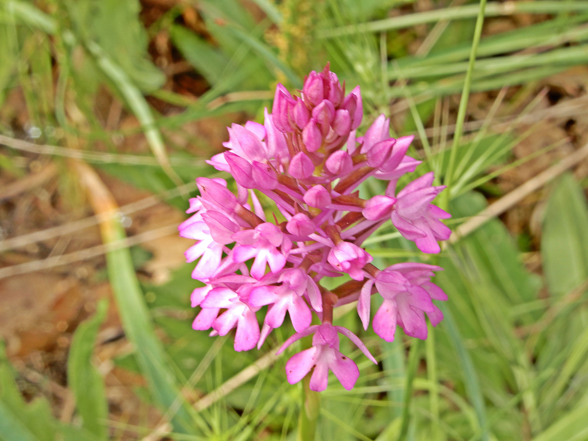
Your gaze will wander over the wild open spaces and the immense horizons along the 85 kilometers trek, the intense scent of mint and thymus will reach you from the cornfields and the rocky pasturelands, the vivid yellow of the giant fennel and the colours of the orchids 🌺 will catch your eye, all of this while the lesser kestrels will keep flying above your head. The land and culture here have been carved by the weather, and made unique by the passage of emperors, farmers, shepherds and woodsmen. Flocks of sheeps will blend with the sharp rocks up the hills, the same sharp rocks that give a name to the place (murex = murice > murgia).
translation by Alessandro Ghio; 📧 a.ghio86@gmail.com


First stage: A breath-taking view of the ridge
|
Length |
22 km |
| Difficulty level | E - medium |
| Altitude gain | +402 m / -541 m |
| Travel time |
8 h (including breaks) |
| Terrain |
wood trails, brecciated roads, cart tracks |
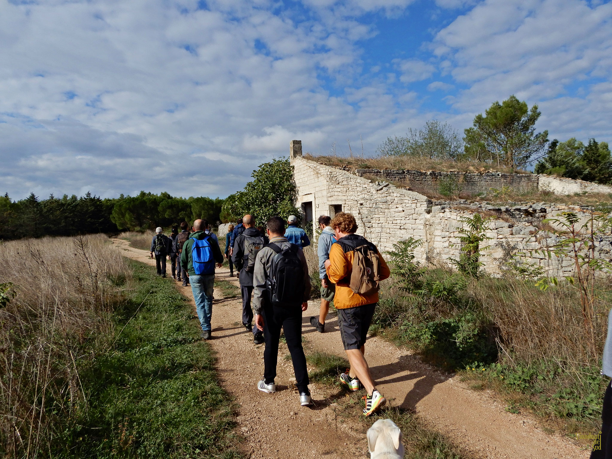
The journey begins at the Acquatetta Forest, the most extended wood in the Province of Barletta-Andria-Trani (BAT) and one of the biggest in the Apulia region. The wood has seen a spontaneous growth of downy oaks (Quercus pubescens) and other typically Mediterranean species such as the kermes oak (Quercus coccifera) and the holm oak. 🌳🌲
Inside the wood are exclusive places such as the Voragine del Cavone sinkhole, with its crater almost hidden deep in the grove.
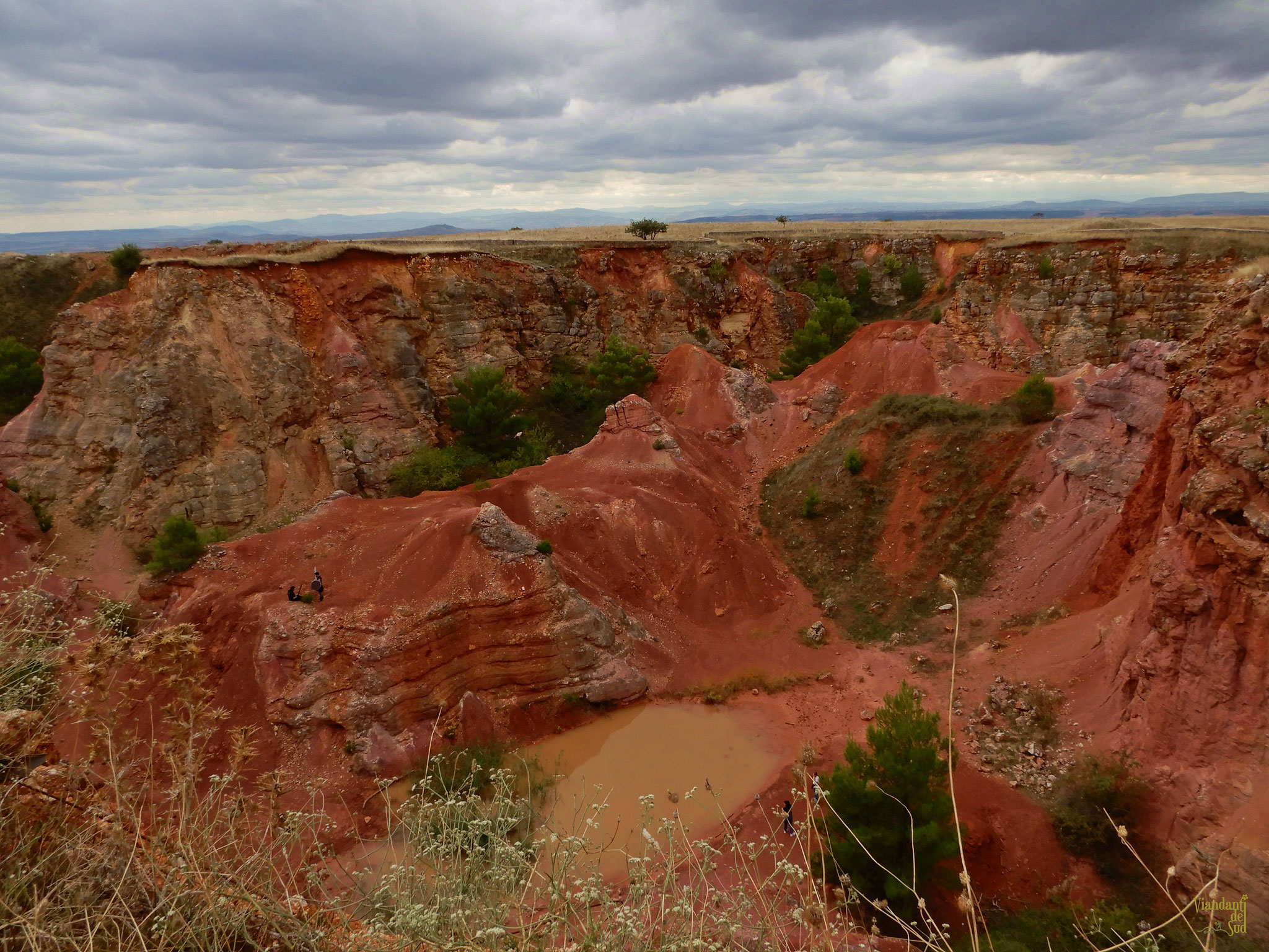
We will then make a brief stop at the Riparo del Cavone shelter, used in the past by shepherds passing by, where pre-historic rock carvings belonging to the Metal Ages can be witnessed, and then pursue our journey along a spectacular windy path through the woods to reach the evocative and rare pink landscape of the Bauxite caves, reminescent of the Grand Canyon and of some Australian views.
The quarries are mainly rust red with splashes of rose as bauxite is a mineral composed mainly of iron and aluminum oxides and hydroxides. Delving into one of those caves will reveal its unique nature, an atypical natural sight indeed. 💗
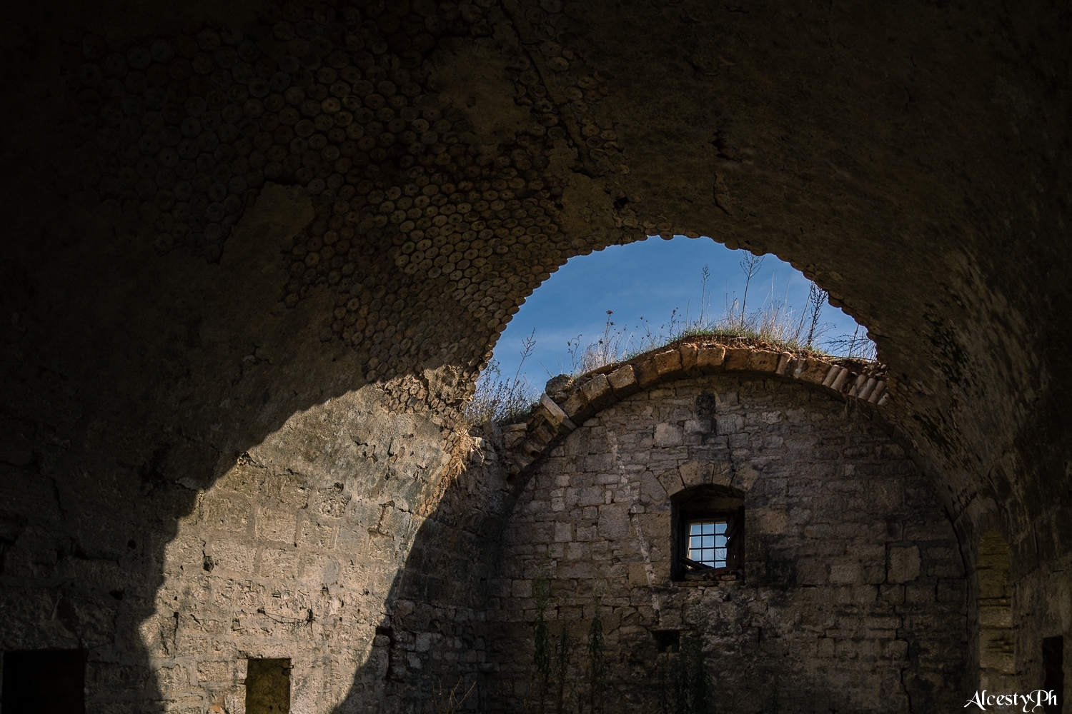
We will continue along the scenic murgian ridge up to the Rocca del Garagnone stronghold ruins 🏰, known locally as the ‘invisible castle’ since it was skilfully built on the rocky spurs of a hill using materials obtained from the hill itself. From the hilltop your eyes will glaze over the colourful Bradanic trench, named after the Bradano river, a vast valley where clay formations can be seen and home to the Basentello and Roviniero rivers. We will then find ourselves in the centre of a network of castles guarding the whole murgian territory, and right in front of us will be the isolated castle of Monteserico, with the final destination of our journey, the Castel del Monte castle, being right behind us. We will then hike down to the valley and end the first stage of our journey in the town of Poggiorsini.


Second stage: Walking along sheep trails
| Length | 21 km |
| Difficulty level | E - medium |
| Altitude gain | +418 m / -315 m |
| Travel time |
7 h (including breaks) |
| Terrain |
wood trails, cart trails, sheep trails |
The town of Poggiorsini - once a manor belonging to the Orsini family, hence the name - looks out to the Basilicata region, and the hills surrounding the Roviniero river are of those you would expect to see in a painting. 💛💚
The place has been inhabited since the early Paleolithic period, also thanks to the presence of freshwater springs nearby. It was one of the stops of the ancient Appian Way and of the Melfi-Castellaneta Sheep Trail. 🐑 In the Middle Ages its territory belonged to the manor of the Garagnone Castle, founded in 1048 by Robertus Guaragna, one of the Norman knights who reached southern Italy first.
In 1220 emperor Frederick II declared the castle as built ‘a fundamentis’, that is from scratch, but studies have shown that the castle may have been either reconstructed or just rearranged, and a ‘domus’, a residence is also mentioned in the documentation.
We will then leave the town to sneak into the Trullo di Sotto wood, which we will pass through following wood trails until we spot the ancient farmhouses and the subsidiary sheep trail which linked to the main Canosa - Ruvo sheep trail.
We will then find ourselves amidst the ‘Quite’ (kwee-teh) of Ruvo di Puglia, agricultural plots of a preexisting estate and a surviving example of 19th century architecture, a landscape marked out by regular patterns of lots and roads delimited by dry stone walls.
We will reach the Agriturismo Coppa holiday farm walking through a land full of ‘karren’, a limestone pavement with surface patterning resembling paving blocks, and sinkholes. The ancient Coppa farmhouse was built by the Coppa family in 1735, and a chapel was also included. Then, in the first decade of the 1800s, the ownership of the farmhouse was transferred to the Jatta brothers, namely Giovanni and Filippo from Ruvo di Puglia, who turned the building into a landlord residence. Towards the end of the Seventies the Caputi family took over, granting a boost to the production of wheat and the breeding of ovine and bovine livestock. The family today offers quality natural food typical of the murgian cuisine, mostly made of their own products such as meat, vegetables, cheese and fresh pasta. 🧀


Third stage: In the oak forest
| Length | 19 km |
| Difficulty level | E - easy |
| Altitude gain | +304 m / -458 m |
| Travel time |
6 h (including breaks) |
| Terrain | dirt tracks, paved roads, wood trails |
Our third day will be steeped in history. Close to the farmhouse is the necropolis of Coppa di Sotto with its thòlos tomb dated 8th century BC. Through the narrow paths enclosed in dry stone walls (a UNESCO heritage) running through the typical rural landscapes of the Murgia, we will take some time to admire the most famous fragno (Quercus trojana) of the entire park, whose majestic and lonely presence has been standing here for generations. 🌳
Next is the Scoparello Wood, a 300 hectares wide wood where downy oaks prevail, some of them centuries-old.
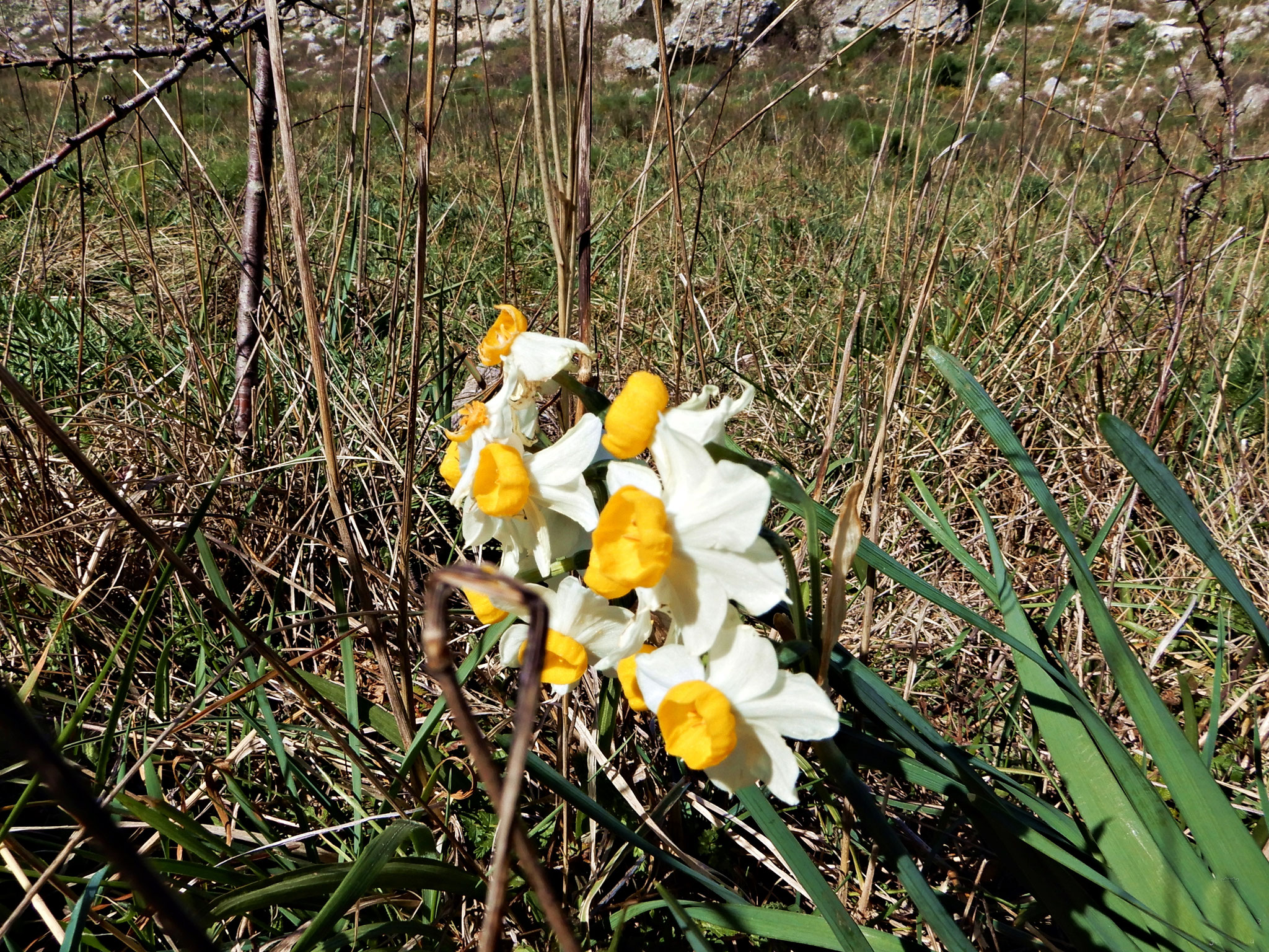
Dog roses, hawthorns, asphodeluses, asparaguses and many other medicinal plants will characterize the walk, all of them typical of the Alta Murgia National Park.
We will end up in a ‘lama’ (a typical apulian erosive furrow) neighboring the Jazzo of the Devil, with its ancient dry stone milking facility where a colossal secular oak also resides. The name of the structure, Jazzo of the Devil, springs from a disquieting local legend of which we will tell you once onsite. 😈🤭
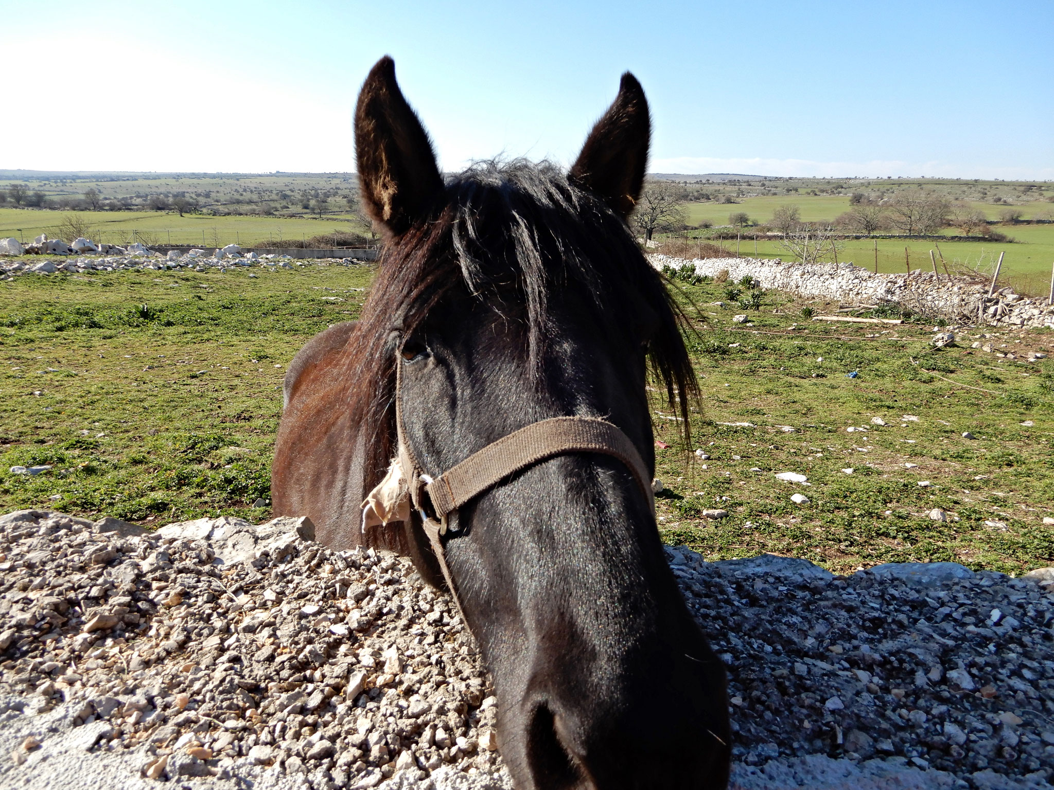
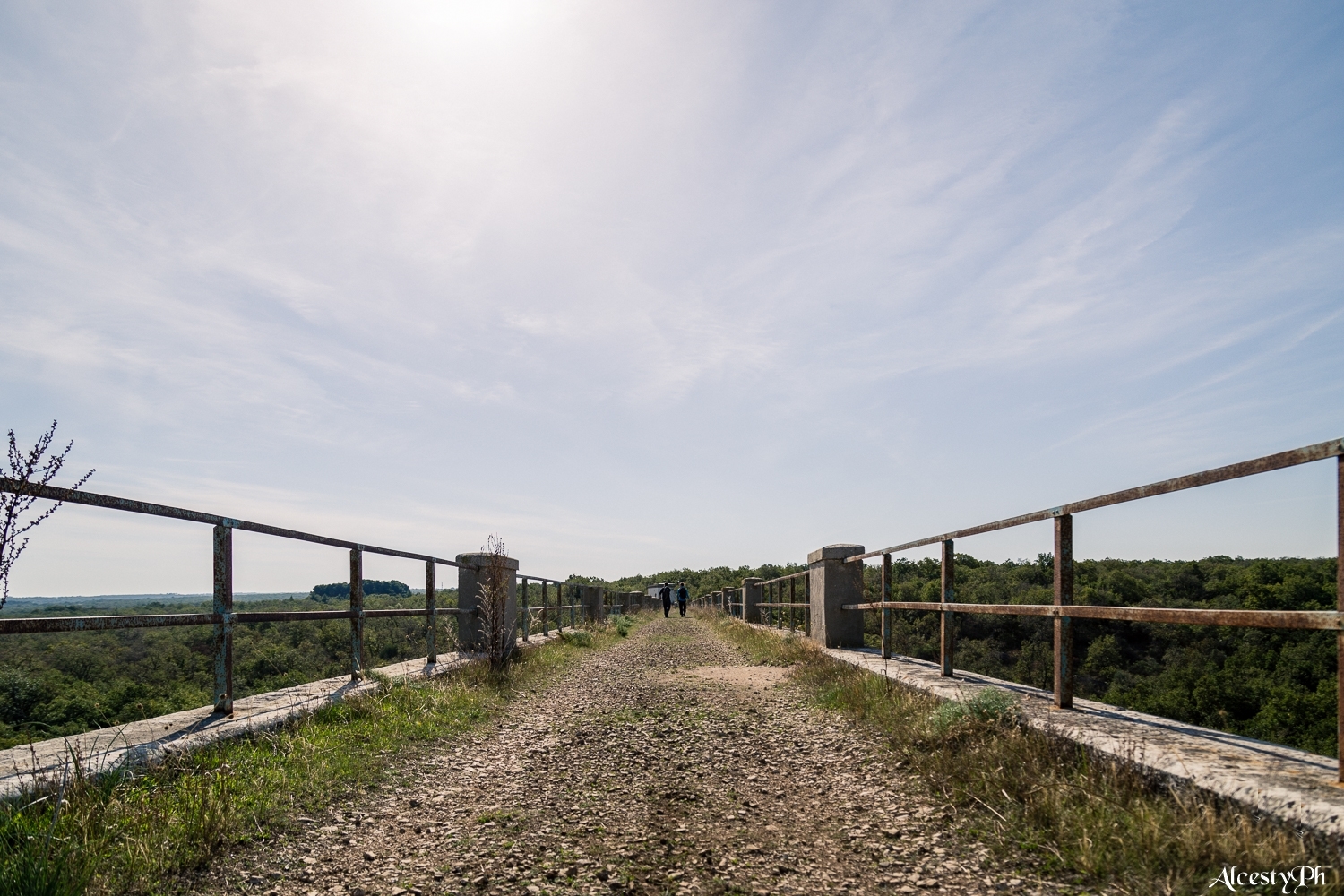
We will then walk along wood trails and up the Apulian Aqueduct bridge that dominates the oak wood from above, and end our journey in the Masseria Tedone farmhouse where you will encounter sheeps, donkeys and cows. 🐑🐴🐮


Fourth stage: Imperial
| Length | 25 km |
| Difficulty level | E - medium |
| Altitude gain | +605 m / -532 m |
| Travel time |
8 h (including breaks) |
| Terrain |
wood trails, brecciated roads, dirt tracks |
Last day of our journey. Between us and the octagonal crown made of stone stands a lenghty dirt track, with the San Magno Necropolis built in the Bronze Age and a charming icehouse church built in 1128 standing in between. In the lower part of the church is the ice-collecting pool that people used to fill with snow that, under firm pressure, would turn into ice. ⛪🧊
We resume our path and finally, after walking through the Cecibizzo Wood, we see it there. Charming and mysterious.
Isolated on top of a typical murgian hilltop, from where a breath-taking panorama can be relished. With its impressive and unsettling shape and size.
A wonderful path will bring us at the foot of the Castel del Monte castle through little houses and haystacks. 👑
The only surviving document referring to the existence of the castle is a letter sent from the town of Gubbio, in January 1240, written by Frederick II the emperor who addressed Riccardo di Montefuscolo, from Capitanata. The letter is about cover work that had to be done regarding the “castro quod apud Sanctam Mariam de Monte”. Later on, the building would have been used as a prison and a ducal residence. It passed through many ownerships, survived many lootings and dispossessions, and was even used by shepherds and thieves, particularly during the 18th century. It was acquired by the Italian Government in 1876 for Lire 25.000 (the currency that preceded the Euro) and it has since then undergone many restorations, the latest of which brought it back to its ancient magnificence.
After visiting the castle, the last steps among olive groves, vineyards and woods will be to reach Agriturismo Sei Carri, where they grow organic barley, wheat, oats and dairy products, and where we will have dinner and spend the night together for the last time
Recommended equipment
🥾 Trekking shoes
🎒 Trekking backpack, comfortable clothing meant for walking, change of clothing, windproof and waterproof jacket, hat
💧 Drinking bottle
Services
💚 Hiking guide
🩹 Insurance coverage
🍴 Overnight stay, dinner and breakfast at the farmhouse
🍞 Packed lunch and water are all provided by us
🚍 Transfer service from the guarded parking to the starting point of the journey
💼 Luggage transportation
❌ Insurance against cancellation
⌚ GUIDED TREKKING: EUR 340,00 per person
AVAILABLE DATES: 18/04/2025 - 21/04/2025
Weather tips
🌱 Temperatures range from 1 to 6°C during winter, reaching negative values and snowfalls in January.
🌸 Springtime will make it possible to gaze at the intense green of wheat fields and rocky pastures, the bright blooming of wild tulips and sword lilies and orchids, the delicate colours of the shining Stipa austroitalica, locally known as ‘stipa of the fairies’. This will blend with the pink of the asphodels or the yellow of the ferula, all while hawks will keep patrolling the sky above your heads.
🌻 Temperatures will be stable around 30°C during summertime, with abundant rainfalls. All of this is making the landscape rather dynamic, so the recommended seasons to walk this trail are:
🍂 In autumn mushroom hunters will walk the meadows holding their wicker basket, looking for the Cardoncello mushroom among the cyclamens and colchicum flowers growing between the ridges and the dry stone walls. The bright colours of summer will slowly fade into orange, and then red and brown. Apart from the colours, the scent of grapes will permeate the air during the harvest period.
Technical organization by Vacantioner Viaggi snc - Bastia Umbra (PG)
By plane: ✈
Bari Palese Airport (45 km)
By train: 🚂
From Bari or Barletta to Andria and bus from Andria to Castel del Monte (active service from 1st April to 1st November)
website: www.ferrovienordbarese.it; www.autolineeandriesi.it
By car: 🚘
Motorway A14 (Bologna-Taranto)
Motorway A16 (Bari-Napoli), exit Andria-Barletta S.S. 170 for about 18 km.
website: www.autostrade.it